|
Building Images
© EA.com
|
Simcity 3000 Cities Page 3
| Picture | Description |
|---|
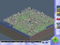
 | Nascentville - 2/18/99 My first city, and the one that's metamorphosized the most and I've spen
t the most time on. Notice how much electricity I'm selling! I have tried unsuccessfully to get the RCI indicator to be + for all three.
|
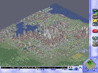
 | Bigville - 2/18/99 I worked on this city for a little while, until it started running too slow. I learned that you don't get the big commercial buildings (4 X 4) until you have a big population >400,000. Notice that commercial demand is high, which is expected once city size reaches a certain point. I had tried putting subway stations in each 9X9 grid of roads, but it was very expensive to maintain the huge grid of subway and the sims didn't seem to be using it much.
|
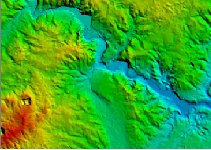
 | Ann Arbor - 3/10/99 This is a sample of elevation data I got from USGS. It's of Ann Arbor (Michigan) and that's the Huron River running through. The flat green splotch in the center is where downtown and the University of Michigan are situated. DLGV32, the data viewer from USGS, allows you to adjust the pallette to black & white. Then, using a graphics editor, one can convert the screen-captured image to the appropriate style bitmap. This is kind of complicated though and I haven't yet gotten around to it. You can find out how to import terrain from Bitmaps in an article at the SC3000 Resource Center Knowledge Neighborhood.
|
|